India Shares Experience in Modernization of Land Records with Sri Lanka
The Department of Land Resources under the Ministry of Rural Development discussed the Digital India Land Records Modernization Programme and geospatial technologies with a delegation of administrative officers from Sri Lanka.
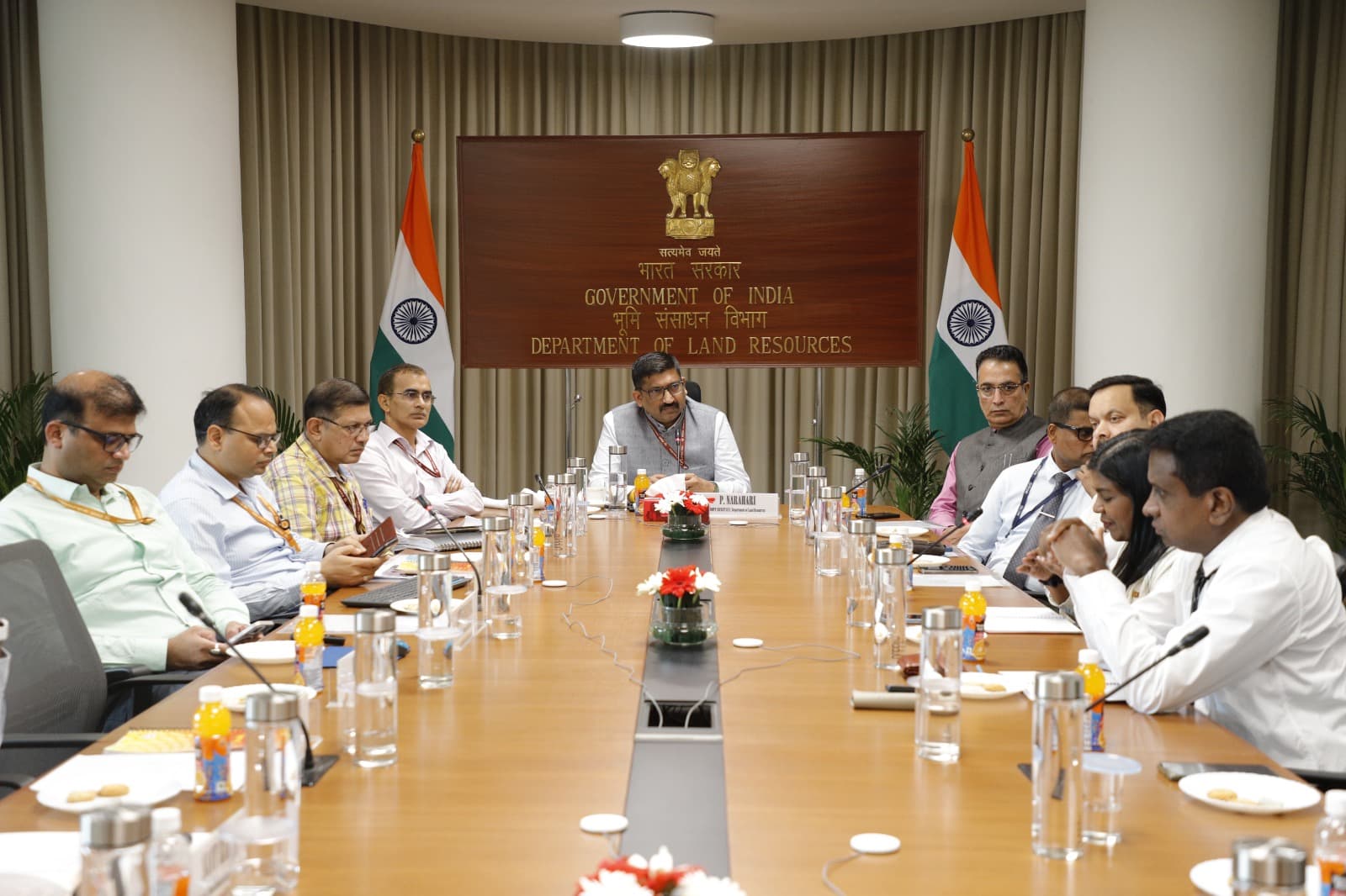
The Department of Land Resources (DoLR) of the Ministry of Rural Development hosted a delegation of administrative officers from Sri Lanka as part of a program coordinated by the National Centre for Good Governance (NCGG). The meeting, chaired by Mr. P. Narahari, Joint Secretary of the Department of Land Resources, aimed primarily to share India's experiences in the digitization and modernization of land records.
During the discussions, particular emphasis was placed on the Digital India Land Records Modernization Programme (DILRMP), the computerization of Records of Rights (RoR), the integration of registration with land records, and the Unique Land Parcel Identification Number (ULPIN). The Sri Lankan delegation was led by Ms. Pathiraj Lakshman Pathmakumari and included senior officials from Sri Lanka's land, survey, and administrative services.
Joint Secretary Mr. P. Narahari stated that land is not merely an administrative record but is deeply connected to livelihoods, economic activities, and the security of citizens. He noted that India has continuously modernized land administration through technology and expressed eagerness to share these experiences with Sri Lankan counterparts while also learning from their methodologies.
Mr. Amit Kumar Singh, Director (LR) of DoLR, provided details on the technical framework of DILRMP, explaining that its objective is to create an integrated land information ecosystem where written records, spatial information, and geospatial technologies complement each other. He shared key achievements of DILRMP, including the computerization of 99.90 percent of Records of Rights, the digitization of 97.43 percent of land registration maps, and the allocation of a 14-digit alphanumeric Bhu-Aadhar (ULPIN) to over 40.58 crore land parcels.
Additionally, the delegation was given an overview of the 'Bharat Land Stack,' a GIS-based infrastructure. This system provides an integrated digital view of any land plot by combining various datasets such as satellite and drone imagery, property registration data, and zoning regulations.
During the meeting, Director (LR) Mr. Sarvadanand Barnwal provided information about the 'NAKSHA' (National Geospatial Knowledge-based Land Survey of Urban Settlements) program. He explained that the program utilizes aerial drones, LiDAR sensors, and 3D reality models to achieve centimeter-level accuracy. He shared that aerial surveys have been completed in 145 out of 150 urban local bodies under the pilot phase, marking progress toward the issuance of legally authentic Urban Property (URPRO) cards.